Isle of Dikes - a historic landscape of the future by Felixx / Felixx
Felixx景观规划公司公布了未来历史景观的愿景
在多德雷赫特岛,废弃堤坝的旧岸线变成了一个新的生活环境,Felixx也响应了荷兰文化遗产服务局与创意产业基金组织关于“抵御极端天气城市规划”的倡议,该倡议旨在开创示范性项目,以应对不断变化的天气与现存的文化遗产之间的对抗适应,因此Felixx与IHE教育研究所在德雷赫特市组成了一个小组共同研究探讨此问题。
Felixx Landscape Architects & Planners has unveiled plans to create a historic landscape of the future.
In the Island of Dordrecht, the old network of disused dikes is turned into a new climate adaptive living environment. Felixx’s vision is part of the ‘Urban Planning for Extremes’ initiative, organised by the Dutch National Service for Cultural Heritage and the Creative Industries Fund. The initiative aims to develop exemplary projects, showcasing an integral approach to the changing climate challenges in relation to existing cultural heritage structures. Felixx composed a team with IHE Delft Institute for Water Education and the municipality of Dordrecht.
文化历史与气候适应
气候变化正在改变我们的环境。在重新规划土地以应对未来风险的同时,人们除了需要受到保护与安全感之外,舒适的建筑环境至关重要。
实现这一目标,关键是要将文化历史价值观与新的空间结构相结合,让现存的景观和环境对人们来说是有特定的价值,要精心将这些现有价值观与新元素结合起来,使迈向未来的道路变得更加容易。这种转变既保留了现有的舒适性,又增加并整合了新风险的保护,还能增加文化景观的可靠性,并能加快在未来的转变速度。
Cultural history and climate adaptation
Climate change is transforming our environment. While reengineering land to prepare for future risks, it is crucial to keep building environments in which people feel comfortable besides being protected and safe.
To achieve this, integrating cultural-historical values with new spatial structures is the key. Existing environments are familiar and landscapes have a certain value for their users. Carefully organizing a transformation that combines these existing values with new elements, makes the step towards the landscape of the future a lot easier to take. The existing comfort is retained, protection against new risks is added and integrated. This increases support at the start and speeds up the transition that follows.
河堤
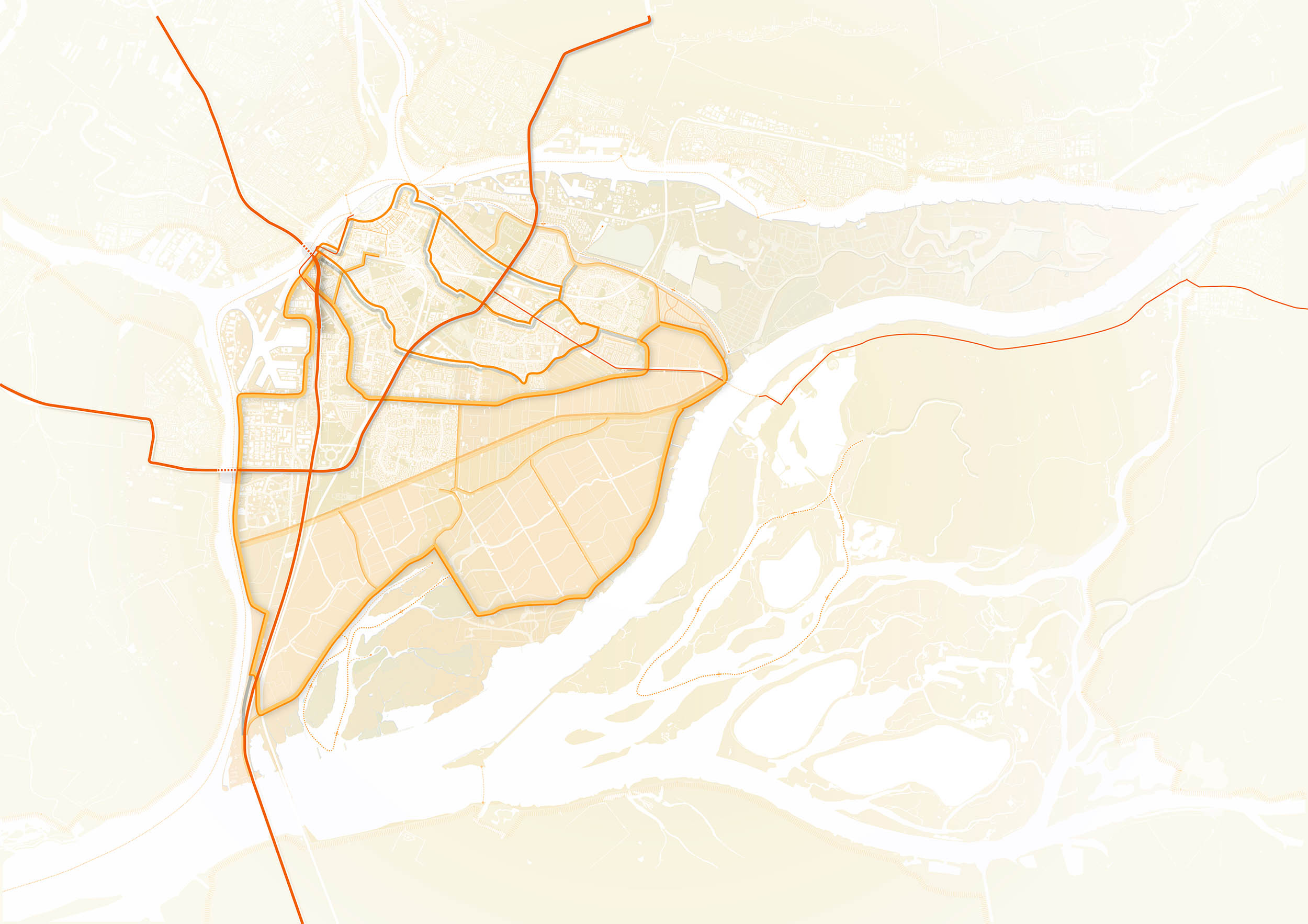
荷兰的组织肌理决定了每一个景观都有一个特定的特征。堤坝可能是这其中最神秘最引人注目的元素。河堤是排水或开垦的地区周围的边界,经常被种植、开垦或建造。近代史以来,多样化和小规模的土方工程网络逐渐形成,为城市提供了边界。近代以来,新的大型防洪工程逐渐取代了传统城市的小防洪堤,使得河堤在很大程度上变成了纯粹的景观元素,但不幸的是,河堤随着城市和农村的发展正在慢慢消失,荷兰的景观因此可能失去它最有特色的身份载体。
我们能重新激活这些河堤并保存它们的存在吗?Felixx探索老式小堤坝作为当代景观的能力
Dikes
The Dutch country is organised by functional structuresthat simultaneously give a specific character to each landscape. Dikes are probably the most mythical and striking element of this culture. They were the borders around areas that were drained or reclaimed and were often planted, cultivated or built. A diverse and relatively small-scale network of earthworks grew, providing identity to urbanized and ruralareas. During recent history, new big flood defences have gradually taken over the role of the small dikes.To a large extent, they have becomesheer aesthetic elements, and often disappear when urban and rural areas are transformed. The Dutch landscape risks to lose one of its strongest identity carriers.
Can we reactivate these heroic structures and preserve their existence? Felixx explored the potential of the old dikes, as a contemporary framework for a climate adaptive landscape.
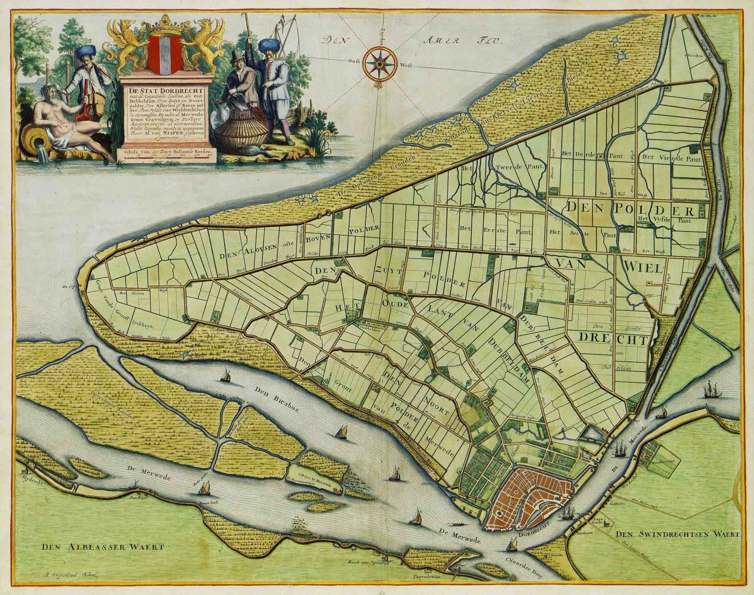
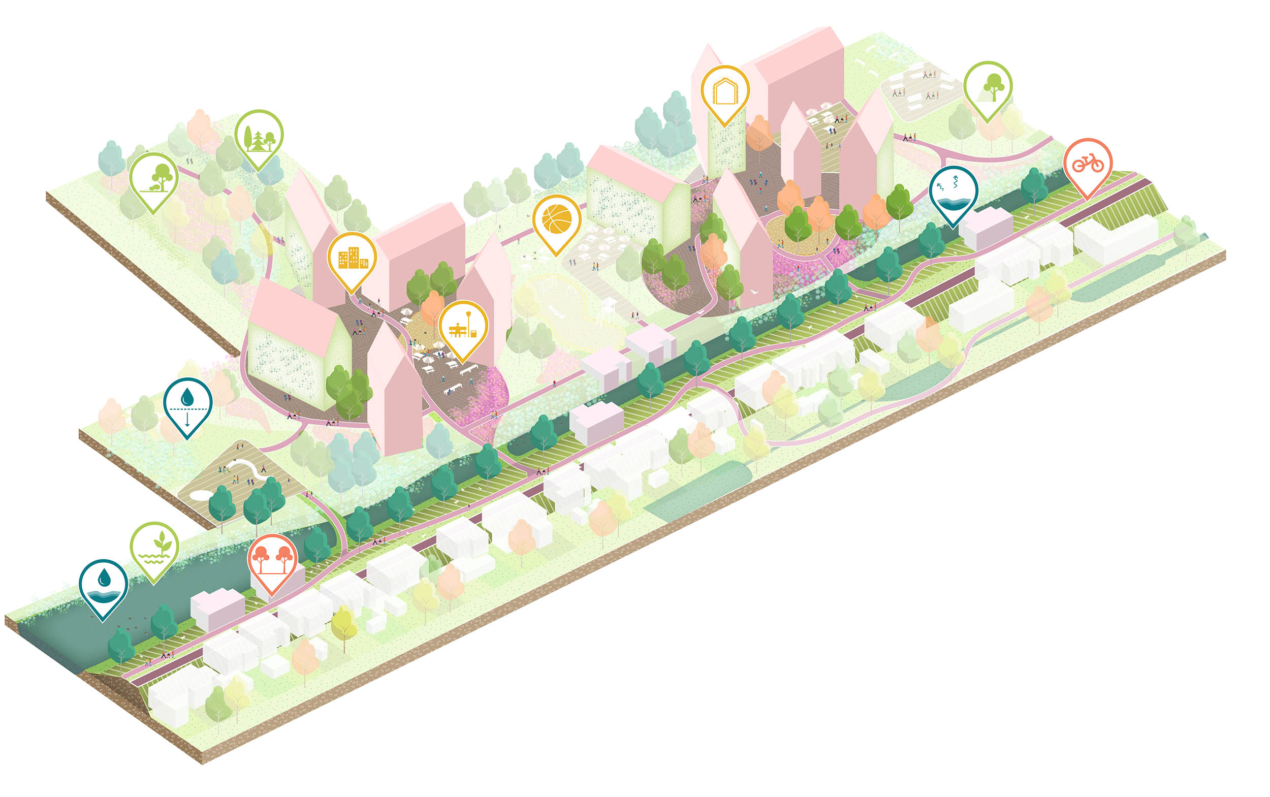
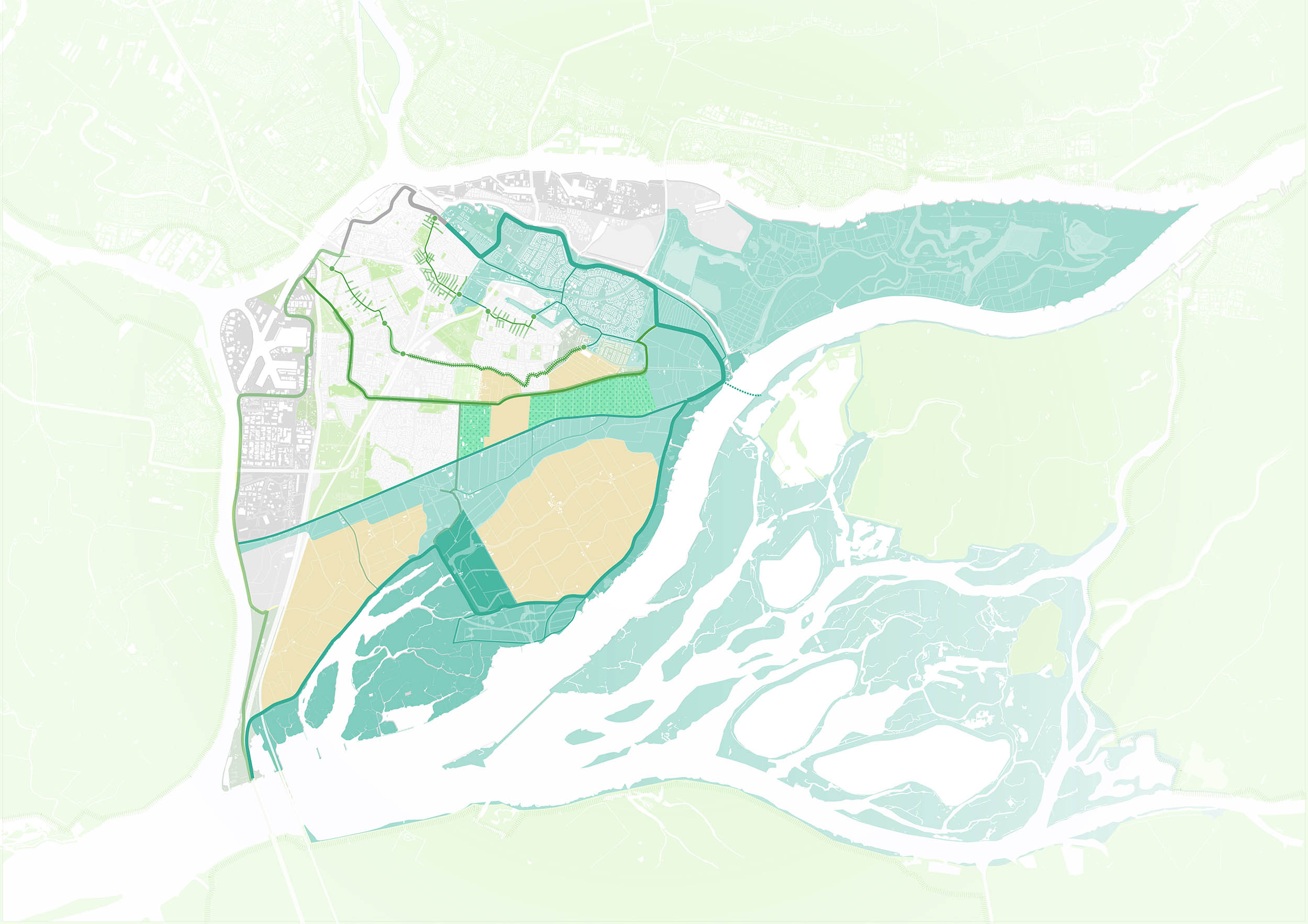
多德雷赫特
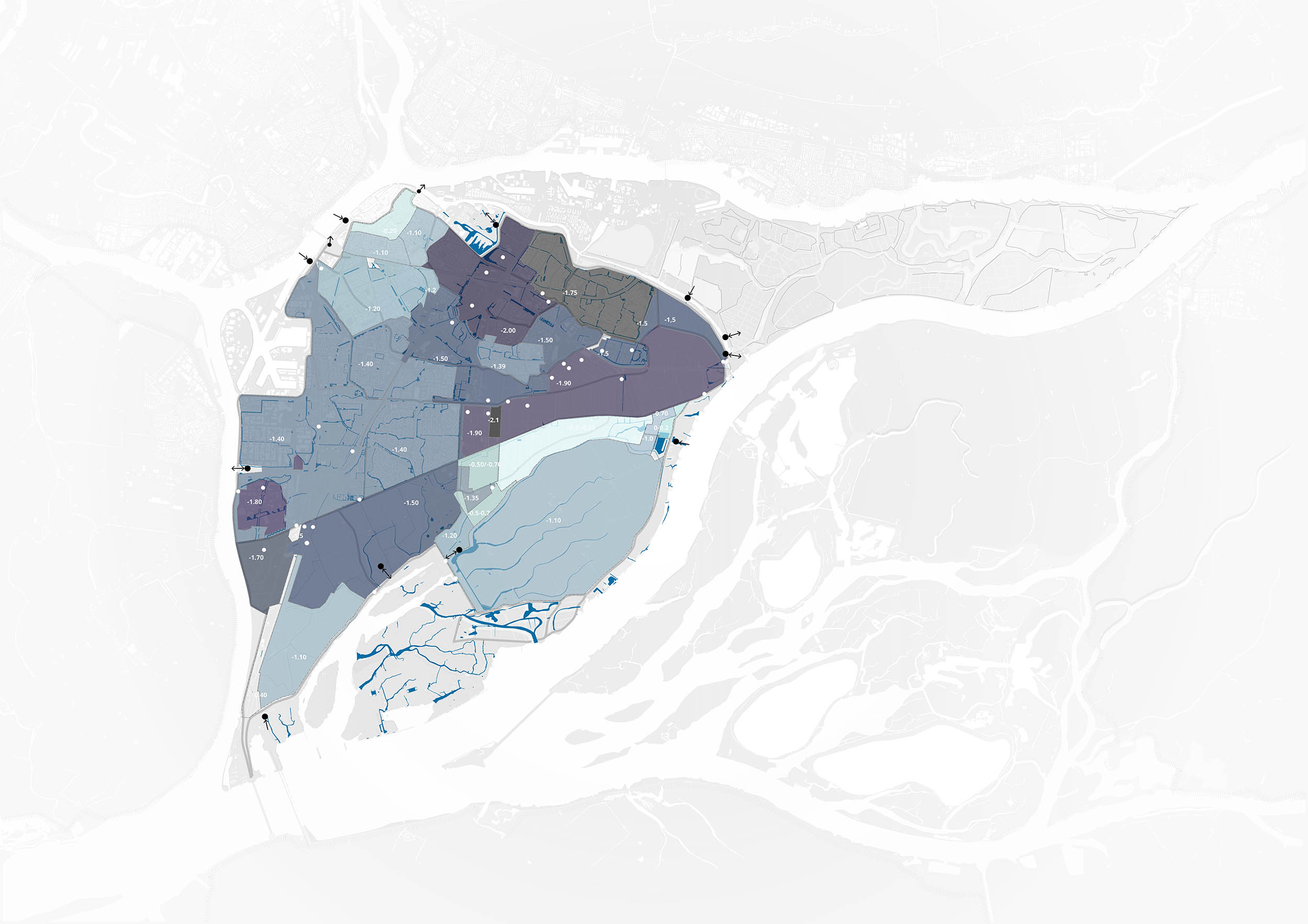
多德雷赫特是荷兰最古老的城市。多德雷赫特岛位于多条河流交汇的湿地区域,周围环绕着密集的堤坝网。和其他许多地方一样,许多内堤因为外河堤的扩大而失去了实际作用。Felixx研究了河堤结构,调查了其历史发展和当前功能。研究结论是多德雷赫特向气候适应型城镇的转变需要通过4个主题进行,每个主题都有各自的要素:水、绿色、项目和基础设施。对于每一个主题,河堤的转变过程都被投射到堤坝的历史布局上。这就产生了3种适应气候的模式。在每一个模式中,所有的转变都完美实现了以河堤作为支柱的景观转变。
Dordrecht
Dordrecht is the oldest city in the Netherlands. Located in a wetland area, where several rivers merge, the Island of Dordrecht is surrounded and veined with a dense network of dikes. As in many other places, a lot of the small inner dikes lost their function because the outer dikes scaled up.Felixx researched the dike structures and assessed their historical development and current functionality.The transformation of Dordrecht into a climate adaptive town is explored through 4 themes with their individual agendas: water, green, program and infrastructure. For each theme, the agendas are projected on the historical layout of the dikes. This results into 3potential models for a climate adaptive Dordrecht. In each model, all agendas are realised, taking the dikes as a backbone for transformation.
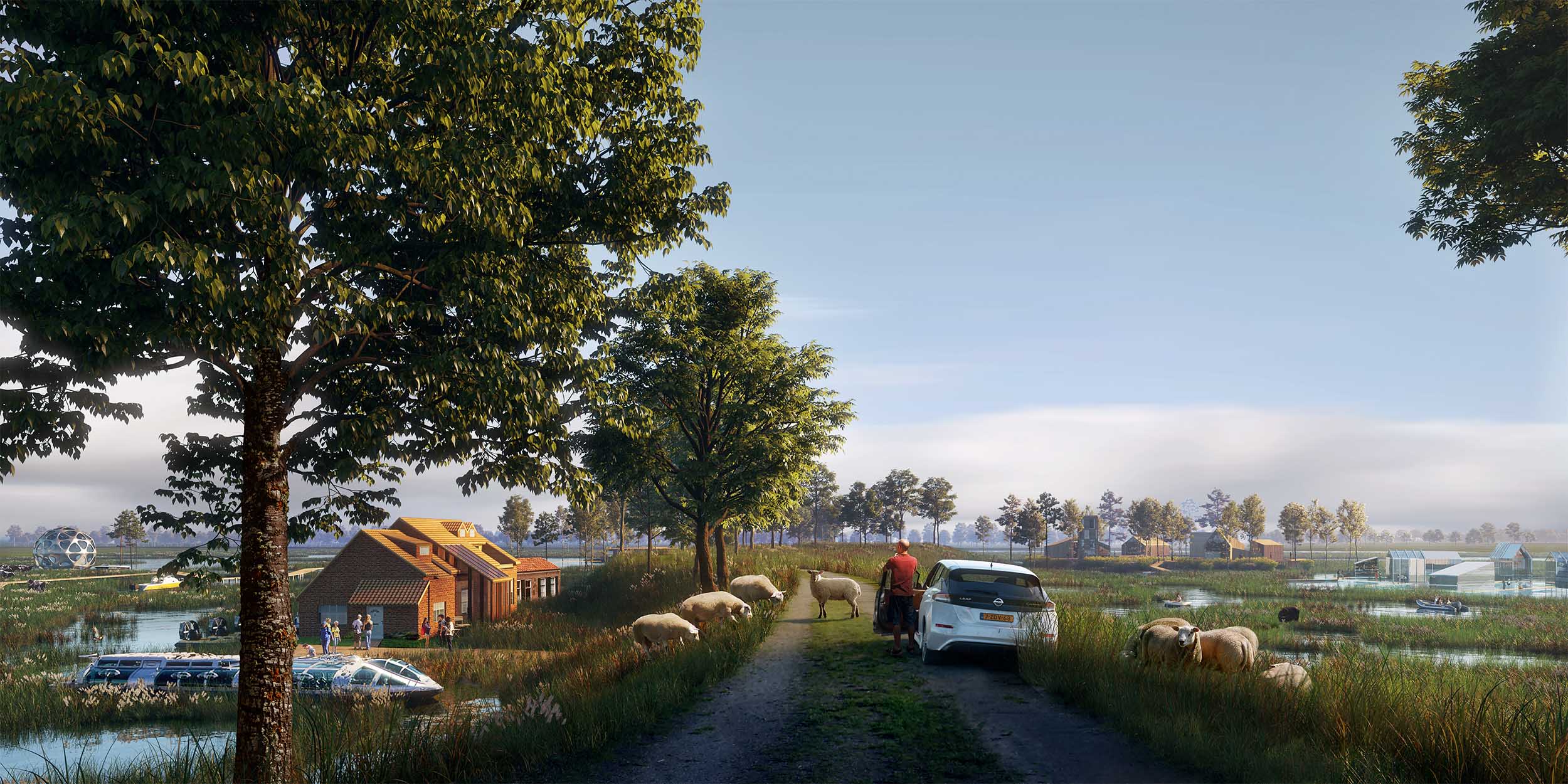
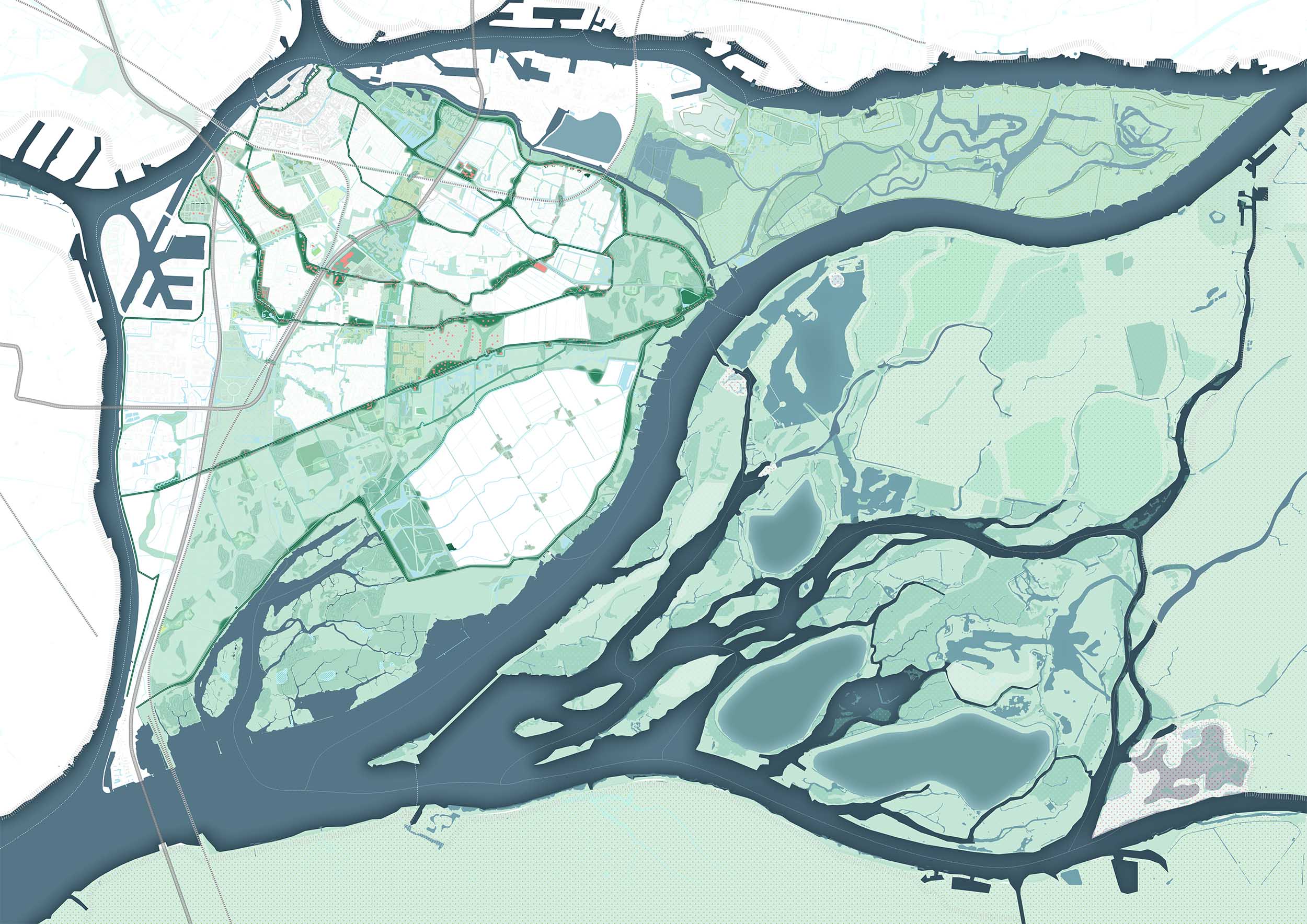
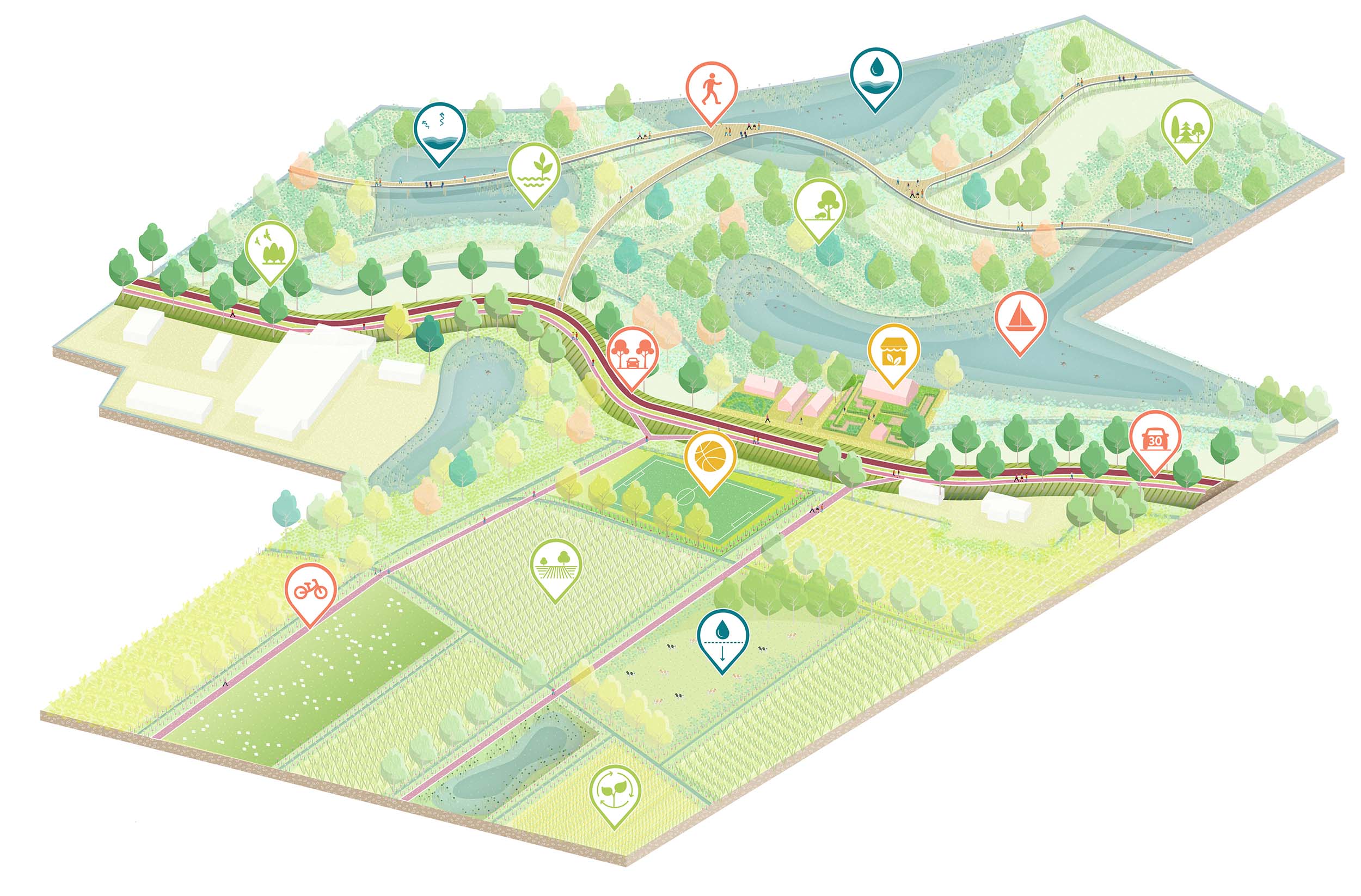
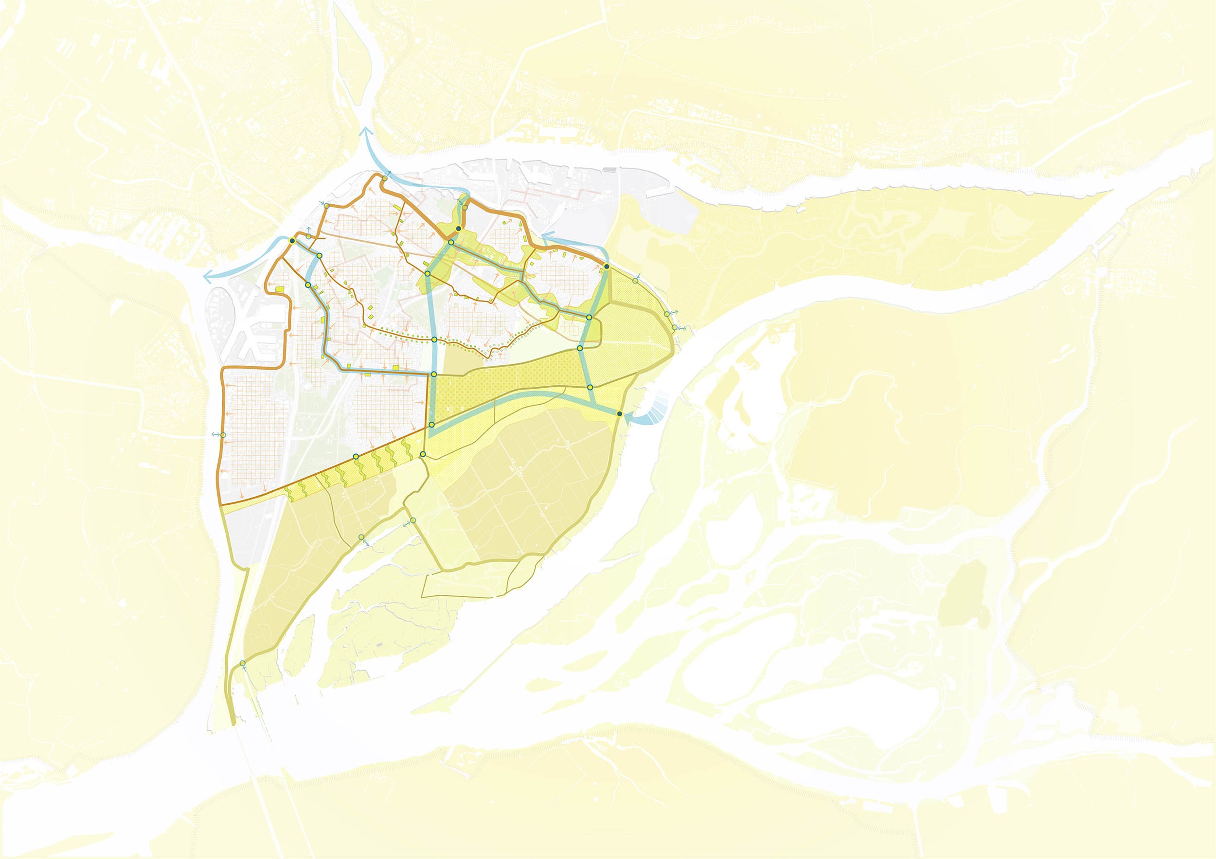
模式一:国家公园“比斯博什”
比斯博什是一个重要的自然保护区,毗邻多德雷赫特。把堤坝变成生态走廊,将多德雷赫特岛融入比斯博什国家公园。自然边界扩展到农村和城市地区,为新的人类住房和娱乐功能提供了空间。沿着堤坝的动态水系统改善了水质,并产生了多种多样的生物群落。生态区整合了行人、自行车和船只的交通路线,并将市中心与比斯博什市中心连接起来。
Model 1: National Park ‘Biesbosch’
The Biesbosch is an important nature reserve, adjacent to Dordrecht.Turning the dikes into ecological corridors, integrates the Island of Dordrecht in the Biesbosch National Park. Natural realms are extended into the rural and urban areas of the island, providing space for new extensive housing and recreational functions. A dynamic water system along the dikes improves the water quality and generates a diverse set of biotopes. The ecozones integrate traffic routes for pedestrians, bikes and boats and connect the city center to the heart of the Biesbosch.
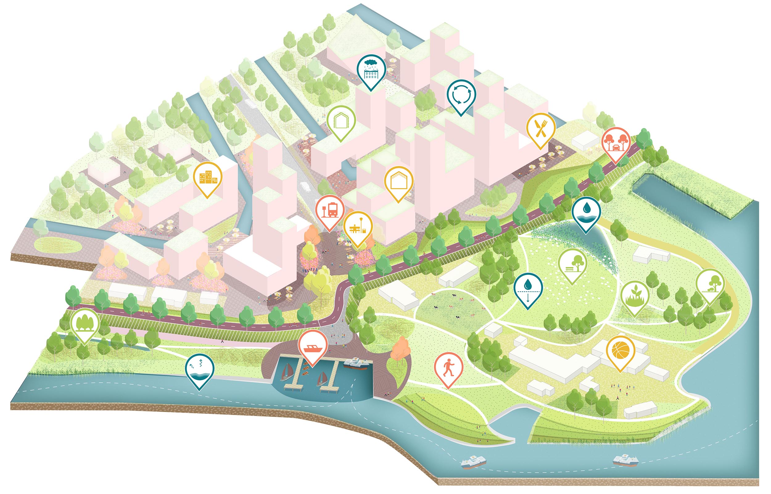
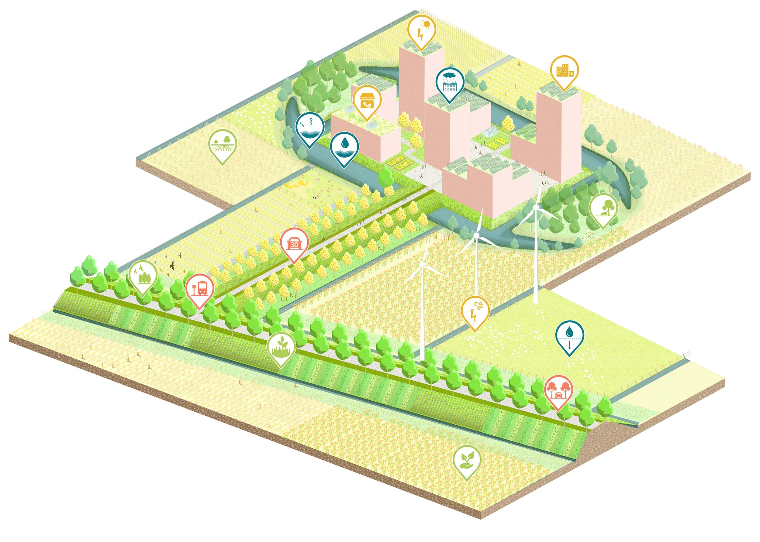
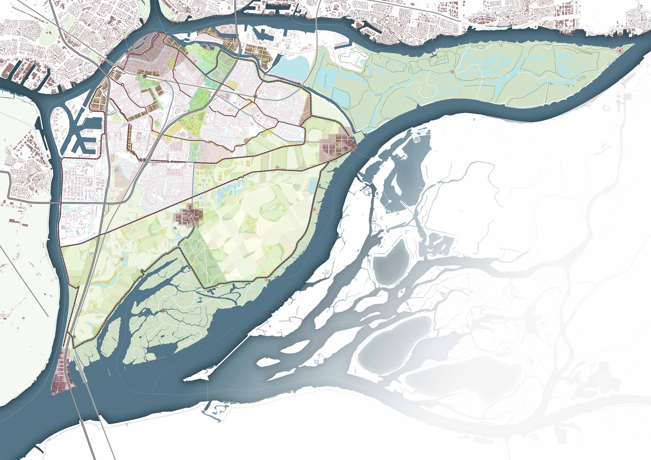
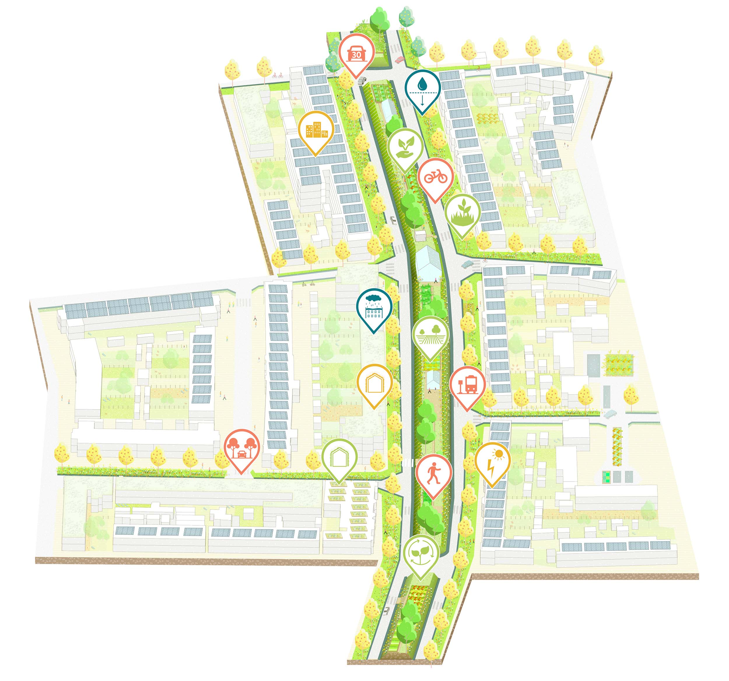
模式二:城域网“兰斯塔德”
兰斯塔德是一个大都市区,横跨阿姆斯特丹、鹿特丹、海牙和乌得勒支,连接着各种各样的中型城镇路网。把堤坝变成一个线性都市公园,可以加强多德雷赫特在这个网络中最南部的重要地位。河堤周围的区域被重新富裕了新的娱乐和居住功能。当与比斯博什逐渐划清边界的时候,会逐渐在岛周围形成大量的卫星城。堤坝被设计成公共空间,并有很多路线,将新的卫星城连接到多德雷赫特中心和兰斯塔德的其他地方。
Model 2: Metropolitan Network ‘Randstad’
Randstad is a metropolitan area, spanned between Amsterdam, Rotterdam, The Hague and Utrecht, connecting a varied network of mid-sized towns.Turning the dikes into a linear metropolitan park, could strengthen Dordrecht as the most southern city within this network. Areas around the dikes are identified and programmed with new recreational and residential functions. New satellite towns arise on the outer edge of the island, as fortresses marking the border with the Biesbosch. The dikes are designed as public spaces and loaded with routes, linking the new Enclavesto the center of Dordrecht and the rest of the Randstad.
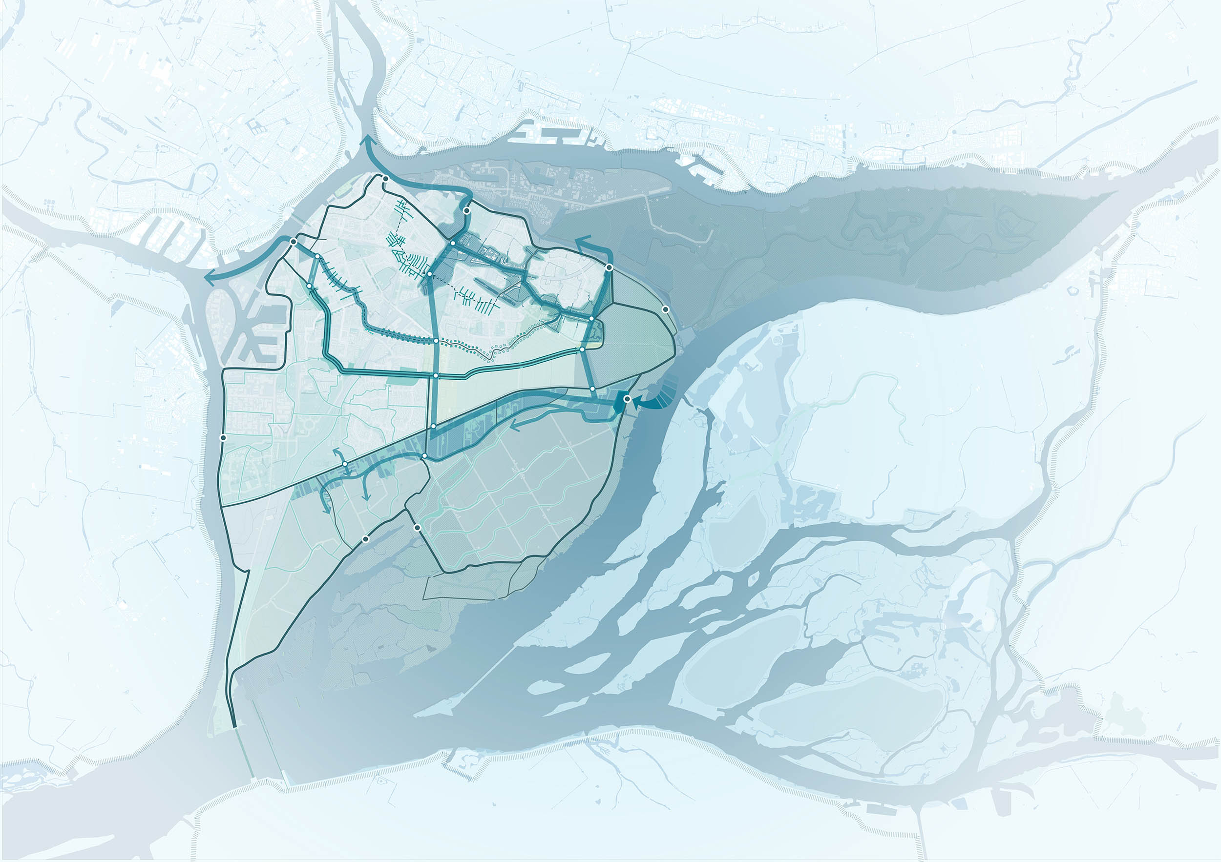
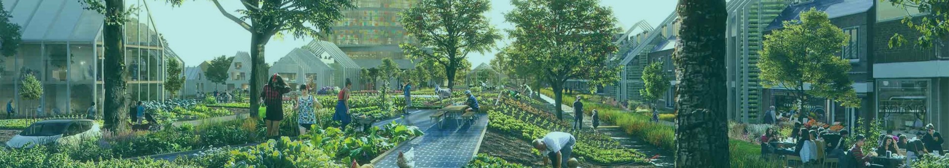
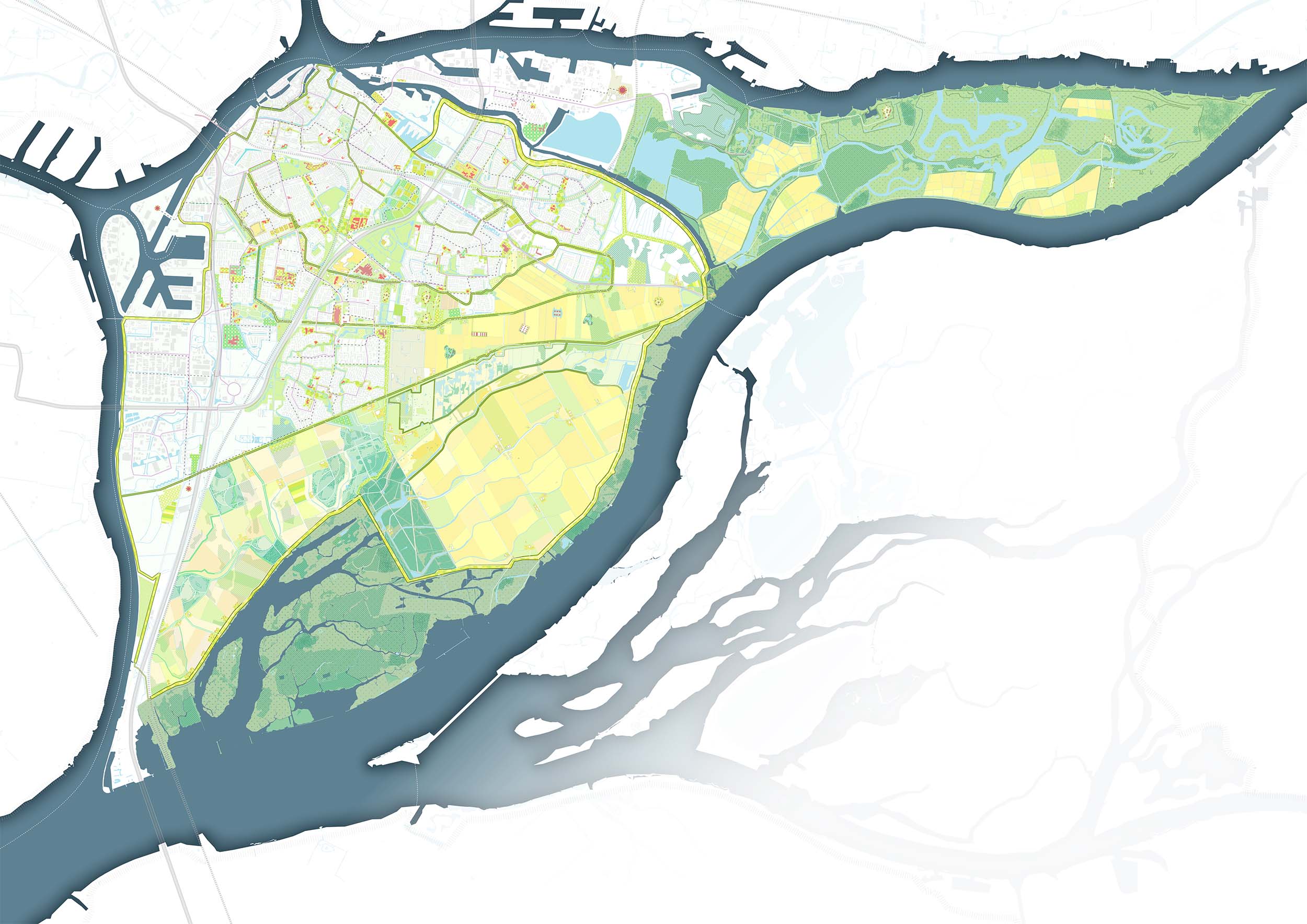
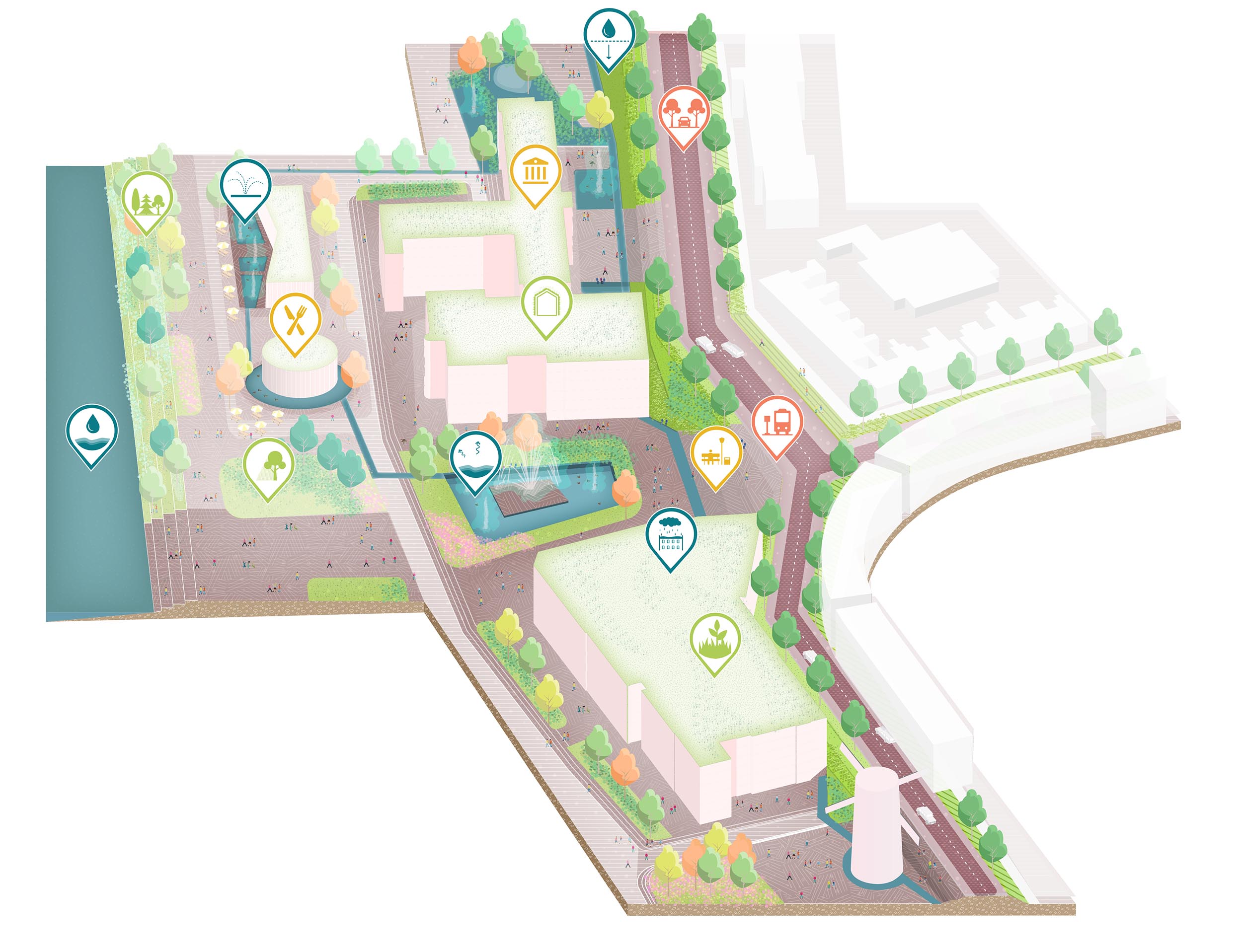
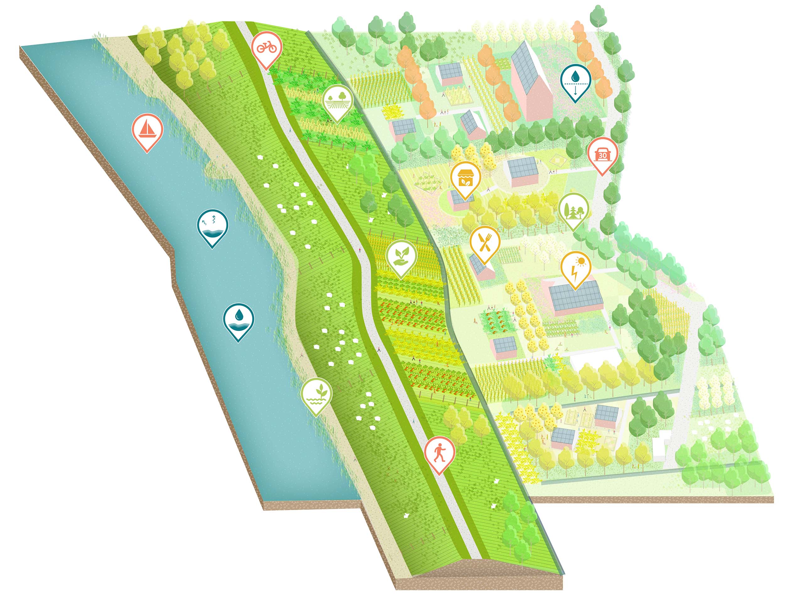
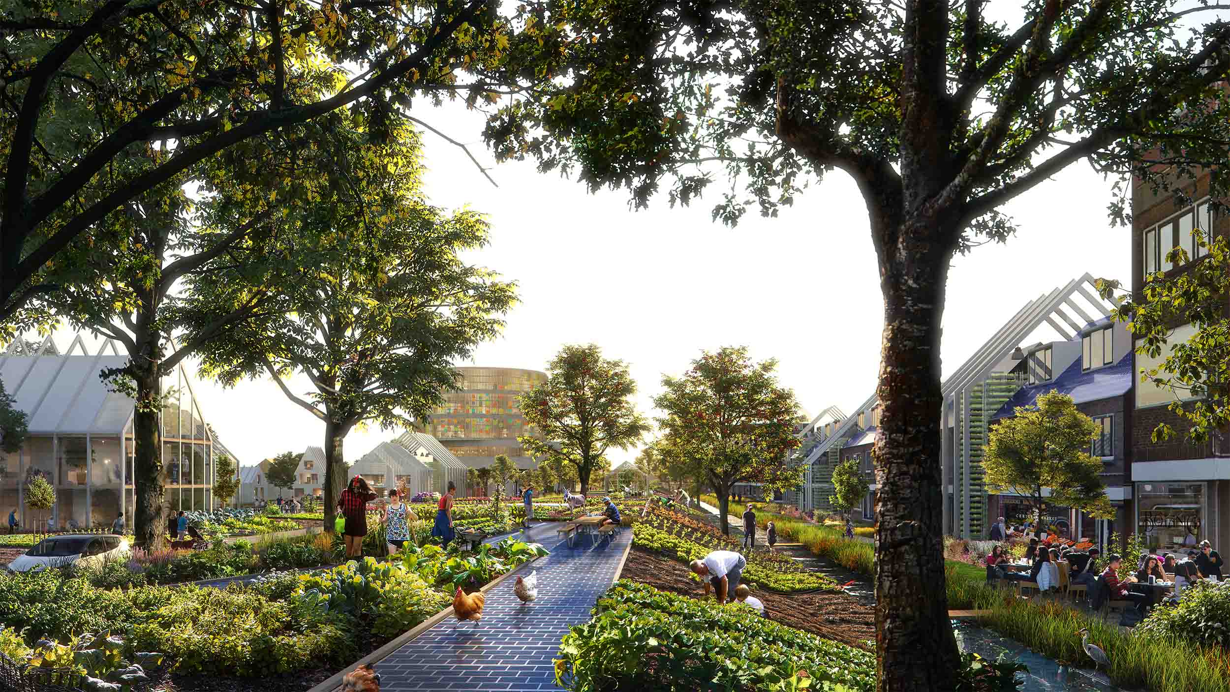
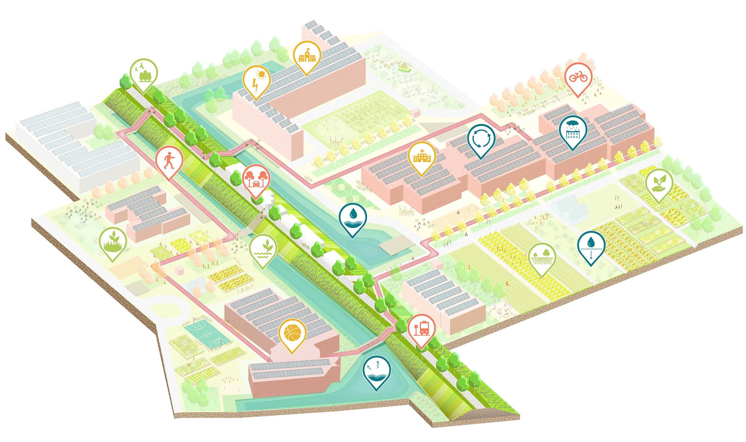
模式三:自给自足的多德雷赫特岛
多德雷赫特岛被河流环绕。将堤坝改造成多样化的生产场地,使多德雷赫特成为自给自足的社区。整合了粮食生产,提供了雨水收集和再利用的空间,促进了能量。汽车配套设施有意减少,慢行系统得到增加。鼓励居民之间的相互联系,实现物资再利用的循环生活方式。河堤成为重要的社会基础设施,为城市农业提供空间,并实现新的服务和设施,如学校、老人院和医院。
Model 3: Self-Sufficient Island ‘Dordrecht’
The Island of Dordrecht is surrounded by rivers. Transforming the dikes into diverse production ground, makes them the backbone of Dordrecht as a self-sufficient community. They integrate food production, offer space to harvest and reuse rainwater, and stimulate the generation, storage and sharing of energy. Car infrastructure is reduced, and slow traffic connections are reinforced. To realize a circular way of living by reusing materials and commodities, the contact between residents is encouraged. The dikes become important social infrastructures by offering space for urban farming, and realizing new services and facilities along them, such as schools, elderly homes and hospitals.
Copyright © 2022 WaSpeak.com, Shanghai & Melbourne, All Rights Reserved.
Privacy. Terms of Use.ICP 2022000905
 编辑推荐
编辑推荐 新锐设计
新锐设计